Ovis
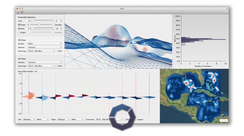
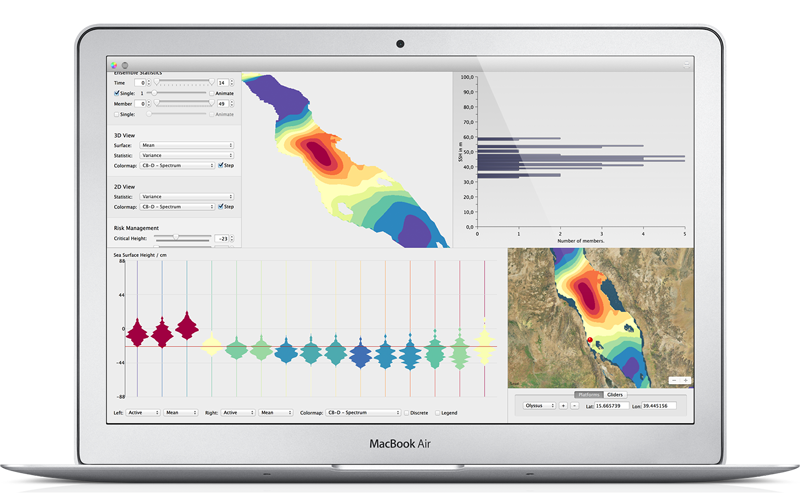
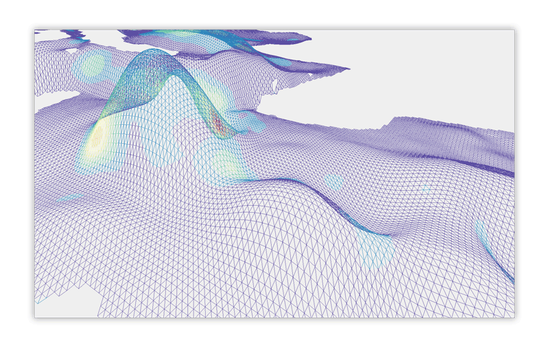
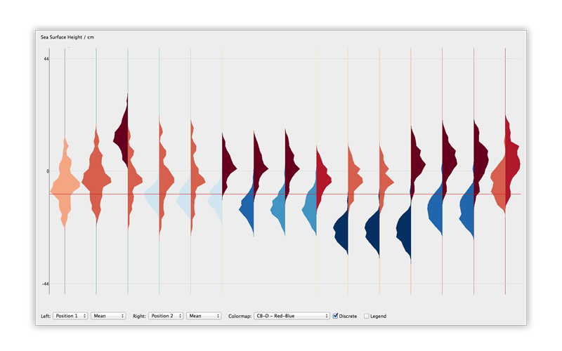
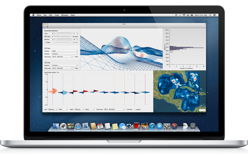
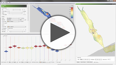
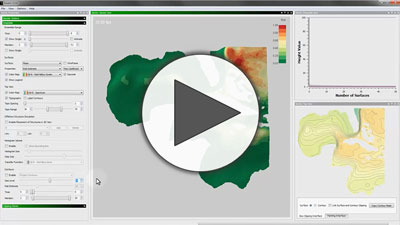
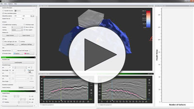
Ovis is a framework for interactive visual analysis of ensemble simulation ocean forecasts. Ovis allows efficient and easy analysis of ocean forecasts and their parameter subspaces by recomputing derived data on the fly, enabling the user to dive into the data, change parameters, select subsets of the ensemble and instantly visualize the results. Ovis is implemented in Objective C and OpenGL. It is a result of my PhD thesis and was developed partly during my time as a PhD student and later as a PostDoc at the High-Performance Visualization Group, part of the Visual Computing Center and the Red Sea Modeling and Prediction Group at the King Abdullah University of Science and Technology.
Ovis in Action.
Publications
The foundation of Ovis builds state of the art research. Please have a look at our related publications.
Visual Analysis of Reservoir Simulation Ensembles.
T. Höllt, F.M. de Matos Ravanelli, M. Hadwiger, and I. Hoteit.
Proceedings of Workshop on Visualisation in Environmental Sciences (EnvirVis) 2016.
Abstract: In this paper we present an an adaption of the Ovis system to support the visual analysis of ensemble reservoir simulation data. The analysis of these data, while similar in kind to Ocean forecast, poses different challenges. We provide tools to inspect forecasts for multiple variables of complete fields, as well as different wells. Finally, we present a case study highlighting the effectiveness of the presented system.


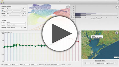
Visualizing Uncertainties in a Storm Surge Ensemble Data Assimilation and Forecasting System.
T. Höllt, M.U. Altaf, K.T. Mandli, M. Hadwiger, C.N. Dawson, and I. Hoteit.
Natural Hazards 2015.
Abstract: We present a novel integrated visualization system that enables the interactive visual analysis of ensemble simulations and estimates of the sea surface height and other model variables that are used for storm surge prediction. Coastal inundation, caused by hurricanes and tropical storms, pose large risks for todays societies...
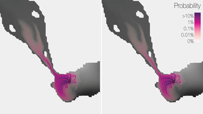
Probability Maps for the Visualization of Assimilation Ensemble Flow Data.
T. Höllt, M. Hadwiger, O. Knio, and I. Hoteit.
Proceedings of Workshop on Visualisation in Environmental Sciences (EnvirVis) 2015.
Abstract: In this work we present an approach using probability-weighted piecewise particle trajectories to allow such a mapping interactively, instead of tracing quadrillions of individual particles. We achieve interactive rates by binning the domain and splitting up the tracing process into the individual assimilation cycles, so that particles that fall into the same bin after a cycle can be treated as a single particle with a larger probability as input for the next time step.
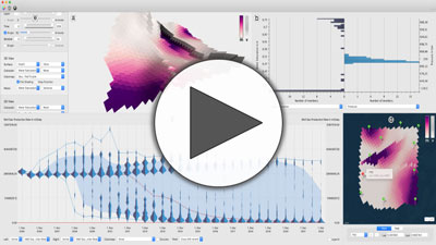
Ovis: A Framework for Visual Analysis of Ocean Forecast Ensembles.
T. Höllt, A. Magdy, P. Zhan, G. Chen, G. Gopalakrishnan, I. Hoteit, C.D. Hansen, and M. Hadwiger.
IEEE Transactions on Visualization and Computer Graphics 2014.
Abstract: We present a novel integrated visualization system that enables interactive visual analysis of ensemble simulations of the sea surface height that is used in ocean forecasting. The position of eddies can be derived directly from the sea surface height and our visualization approach enables their interactive exploration and analysis. The behavior of eddies is important in different application settings of which we present two in this paper...
Visual Analysis of Uncertainties in Ocean Forecasts for Planning and Operation of Off-Shore Structures.
T. Höllt, A. Magdy, G. Chen, G. Gopalakrishnan, I. Hoteit, C.D. Hansen, and M. Hadwiger.
Proceedings of IEEE Pacific Visualization Symposium 2013.
Abstract: We present a novel integrated visualization system that enables interactive visual analysis of ensemble simulations used in ocean forecasting, i.e, simulations of sea surface elevation. Our system enables the interactive planning of both the placement and operation of off-shore structures. We illustrate this using a real-world simulation of the Gulf of Mexico... Honorable mention for best paper award.
Extraction and Visual Analysis of Seismic Horizon Ensembles.
T. Höllt, G. Chen, C.D. Hansen, and M. Hadwiger.
Eurographics (short papers) 2013.
Abstract: In this paper we show the techniques used to build Ovis applied in another application area, namely seismic interpretation. Seismic interpretation is an important step in building subsurface models, which are needed to efficiently exploit fossil fuel reservoirs. However, seismic features are seldom unambiguous, resulting in a high degree of uncertainty in the extracted model. We present a novel system for the extraction, analysis and visualization of ensemble data of seismic horizons...